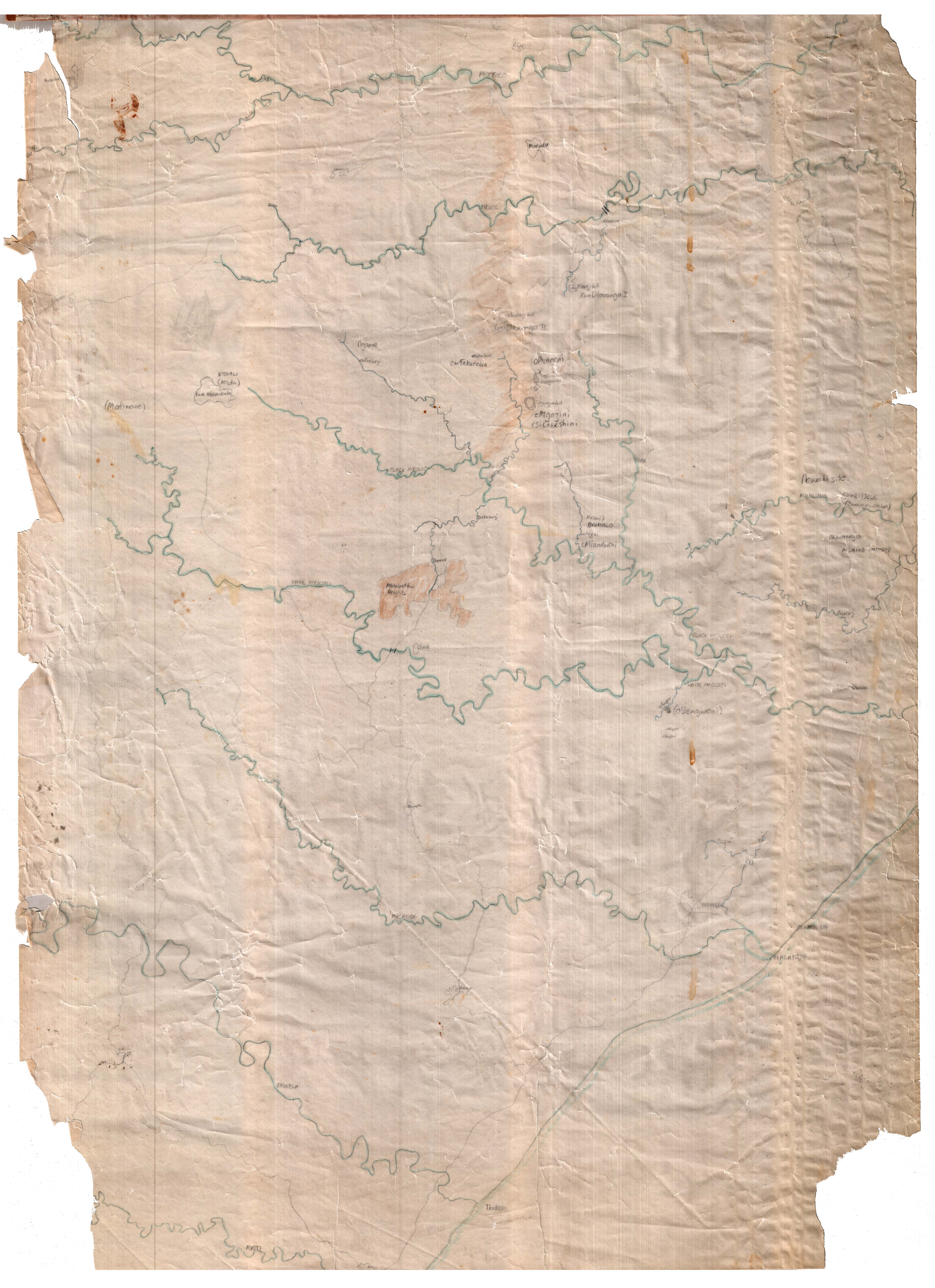
Transparency map of the region between the Black uMfolozi and uPhongolo rivers
Images
Metadata
Title
Transparency map of the region between the Black uMfolozi and uPhongolo rivers
[ Source of title : FHYA using information provided by Ronette Engela ]
Material Designation
Object
Textual record
Reproduction Conditions
Creative Commons License: CC BY-NC-ND
https://creativecommons.org/licenses/by-nc-nd/4.0/
Descriptions and Notes
[Source - Ronette Engela for FHYA, 2024: Transparency map traced by Ronette Engela of the region between the Black uMfolozi and uPhongolo rivers, showing details of and locations for historical Ndwandwe sites located by Engela in the course of her fieldwork, as well as the site of oYengweni II associated with King Dingiswayo.]
Events
| Event Actor | Event Type | Event Date | Event Description |
|---|---|---|---|
| Five Hundred Year Archive (FHYA) | Online curation | 2024- | |
| Five Hundred Year Archive (FHYA) | Digitisation | 2023 | Digitised by UCT Digital Library Services (DLS) |
| Ronette Engela | Custody | [between 1995-1997-] | Possibly sourced from KwaZulu-Natal Archives & Records Services? |
| Ronette Engela | Collection | [after c.1995] | |
| Ronette Engela | Making | c.1995 |
Direct Links
If you have difficulty accessing the objects, use these links.
Transparency map of the region between the Black uMfolozi and uPhongolo rivers
Page actions:code view XML metadataexplore explore from here
Contributions