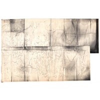
Tracing of James Stuarts' map of Zululand watercourses
Metadata
Title
Tracing of James Stuarts' map of Zululand watercourses
[ Source of title : FHYA using information provided by Ronette Engela ]
Material Designation
Object
Textual record
Reproduction Conditions
Creative Commons License: CC BY-NC-ND
https://creativecommons.org/licenses/by-nc-nd/4.0/
Descriptions and Notes
[Source - Steve Kotze for FHYA, 2024: Transparency copy of James Stuart map of Zululand watercourses File 51(i) KCM24142, Killie Campbell Africana Library, University of KwaZulu-Natal.]
Events
| Event Actor | Event Type | Event Date | Event Description |
|---|---|---|---|
| Five Hundred Year Archive (FHYA) | Online curation | 2024- | |
| Five Hundred Year Archive (FHYA) | Digitisation | 2023 | Digitised by UCT Digital Library Services (DLS) |
| Ronette Engela | Custody | [between 1995-1997-] | Sourced from Killie Campbell Africana Library |
| Ronette Engela | Collection | [between 1995-1997] | |
| James Stuart | Making | Before 1942 |
Direct Links
If you have difficulty accessing the objects, use these links.
Page actions:code view XML metadataexplore explore from here

Contributions